High Production Forestry Plans - Goldsmith and Chain Lakes Areas - January 2026
12 January, 2026 - Reading time: 4 minutes
Maps of High Production Forestry Plans for the Chain Lakes and Goldsmith Areas.
Many areas of Crown Land have already been designated for High Productions Forestry and there are a couple that are presently (Jan 12, 2026) open for comment to NSDNRR.
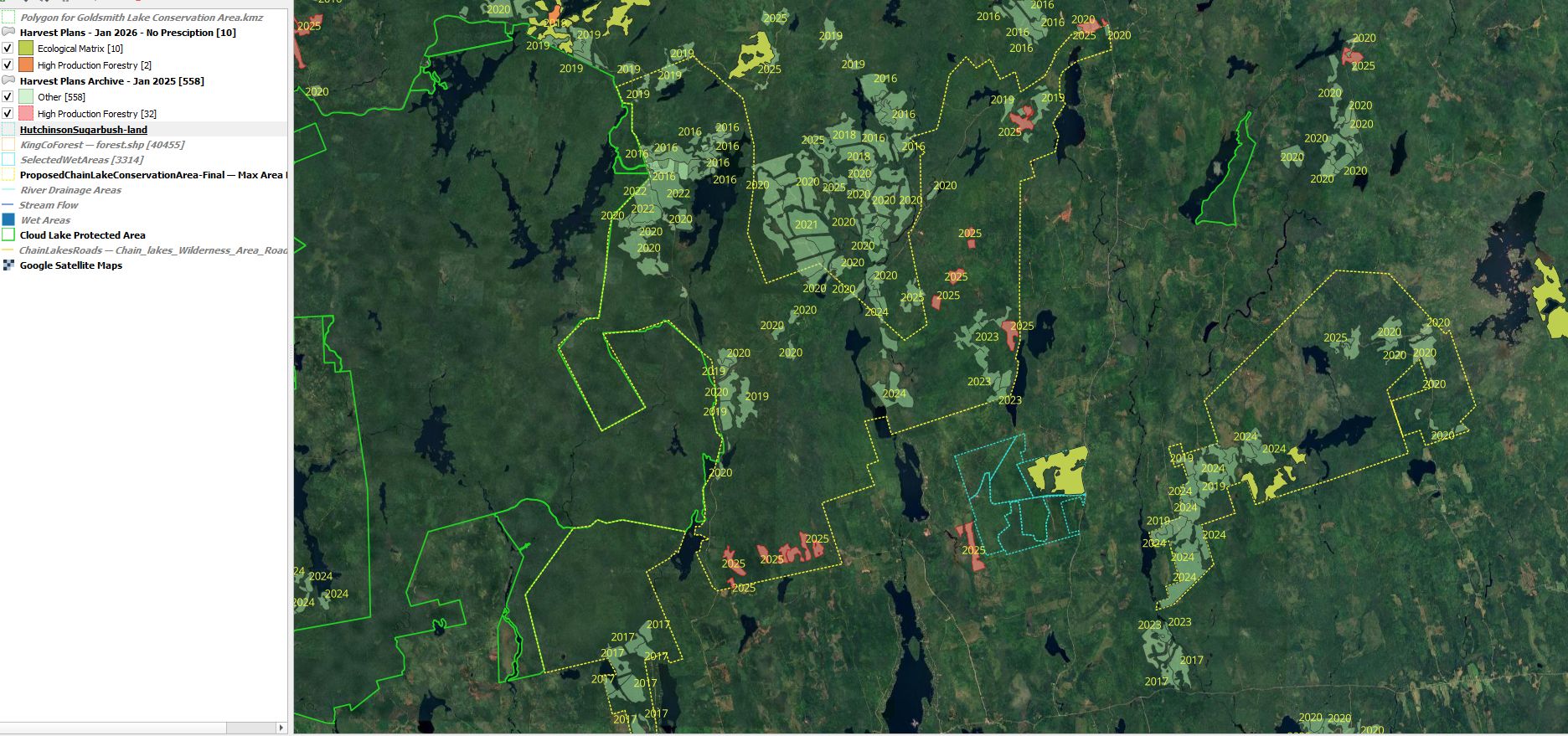
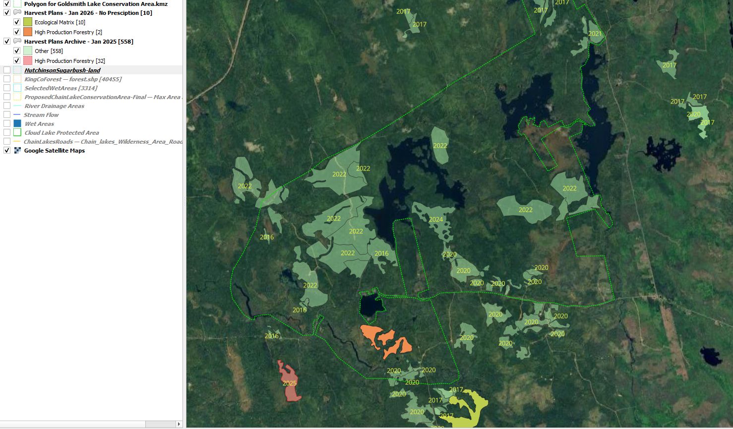
The Maps below are thumbnails of larger maps. The maps on the left are jpeg maps that show all the archived harvest plans from 2016 to present. On these maps the green shaded areas are archived plans and have dates of release as labels. The High Production Forestry plans are red and orange. The red are past comment period. The orange are available for comment before 17th of January (2025).
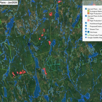
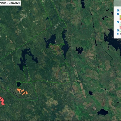
The maps on the right only show the High Production Forestry Plans. The map and title are links to a GIS Webmap that allows for popup information, and zoom in on the satellite maps. The legend allows you to toggle the plan on and off to see below the shaded color. I have added wet area, lakes, and stream information on the Chain Lakes GIS Map. Unfortuately, I did not have that information available for Goldsmith Lake area.
Both type of maps have legends which help identify features.
The Jpeg maps may be downloaded using right click on the map. The GIS are webpages and the complete webpage can be downloaded for use on your local computer.
|
Chain Lakes Wilderness Area Map |
Chain Lakes Area - High Production Forestry Plans Active Webpage with GIS Map. |
 |
 |
| Goldsmith Lake Wilderness Area Map (Click on the Map Below for a Full View) |
Goldsmith Lake - High Production Forestry Plans Active Webpage with GIS Map |
 |
 |