Curry Brook - Up and Down - Down and Up for Geocaches
11 February, 2025 - Reading time: 15 minutes
This is a description of my adventure in the Autumn of 2020 to explore a gorge on the north edge of the Southern Uplands of Kings County, Nova Scotia. A geocacher with the interesting moniker of Junior Woodchuck Huey, had hidden nine caches along the stream, called Curry Brook. In two separate hikes, one from the bottom and one from the top of the stream, I found all of them. The two routes overlapped so I saw the entire section of this interesting area.
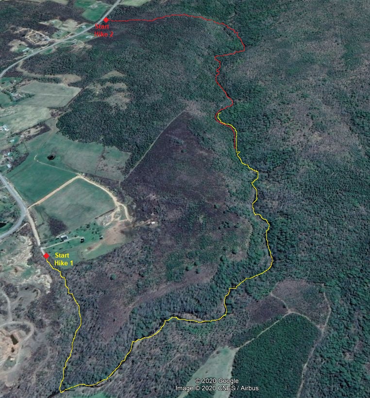
The image to the right is an aerial view (Google Earth View) of Curry Brook and tracks of my two hikes. The yellow track is the first (Hike 1) and the red track done a couple days later (Hike 2). There are no trails along the brook and most of the walking was done on the edges and in the stream. Rubber boot are necessary most of the year.
NOTE: Click on the images to see an larger version
Although Hike 1 was the longer of the two, it was easier in the sense that the lower part of Curry Brook is wider and less confined and made for easier access and walking along the upper brook, On Hike 2, I had to use rope aides to descend a steep cliff, then the gorge was so narrow, at places, it was impossible to walk on the edge of the stream and required climbing over steep embankments.
HIKE 1 (31 Oct 2020)
My access for Hike 1 was at the end of Pinch Road off of West Brooklyn Road. From this spot I had to bushwack down the gully at the end of the road until I reached Curry Brook. I then walked upstream mostly on the edge of the stream and sometimes on the bank when there was one. Soon there were no banks to walk on and I had to cross the stream many times and walk the edge of the stream. It took me a couple of hours to walk up as far as I went but I was geocaching along the way. When I returned to the car, it only took me 40 minutes to walk out. I had my rubber boots and sturdy staff, to help in my travels. The temperatures were cool, about 5 C during my travels.
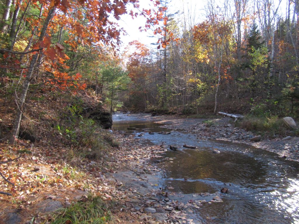 |
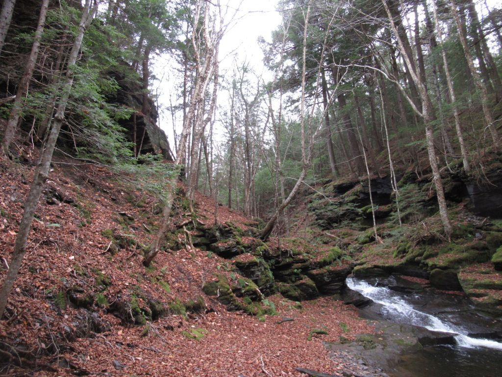
Curry Brook empties into the Gaspereau River and the Gaspereau Valley is a pretty agricultural location. This lower end of the Brook crosses fields and is very open, this image gives a view up stream where it leaves the woods at the edge of the southern upland. |
 |
The first geocache up Curry Brook was on the side of a rock face in the stream bed. The stream at this time was flowing but not vigorously. None of the stream was so deep that it would cover my rubber boots so I could cross back and forth to get to the gravel beside the stream which was less slippery than in the stream. |
 |
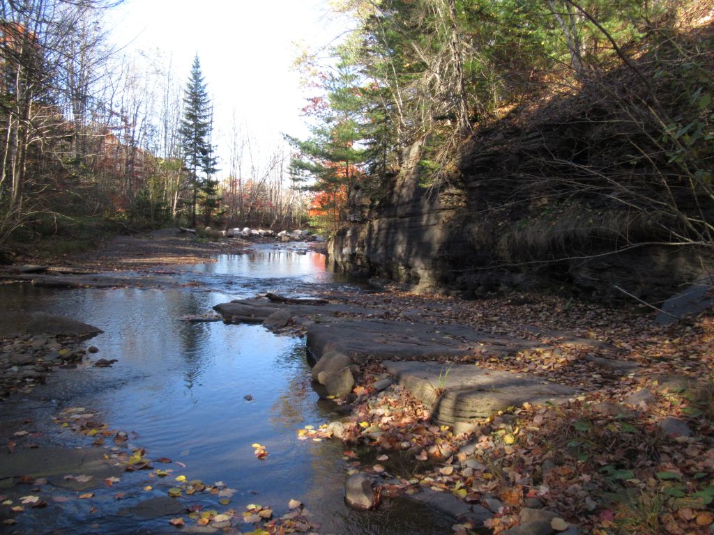
As I walked up stream, the sides of the gorge became higher and higher. This image shows one of the sharp turns in the stream around a high rocky bank. |
 |
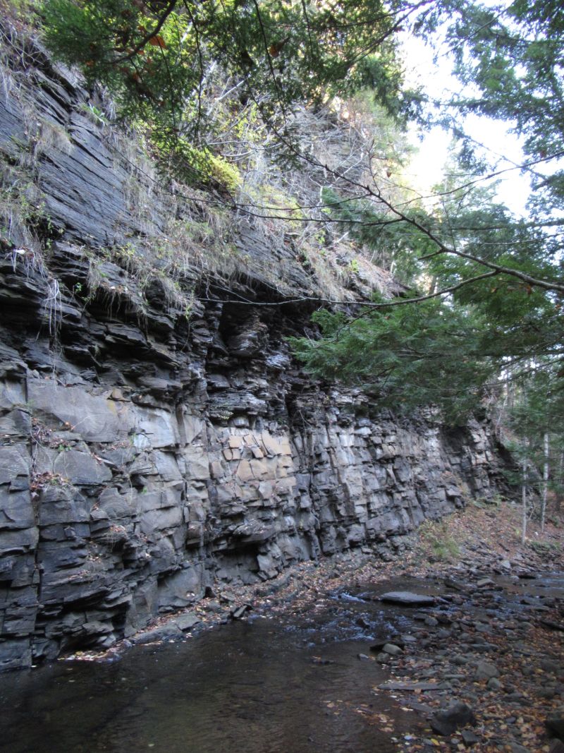
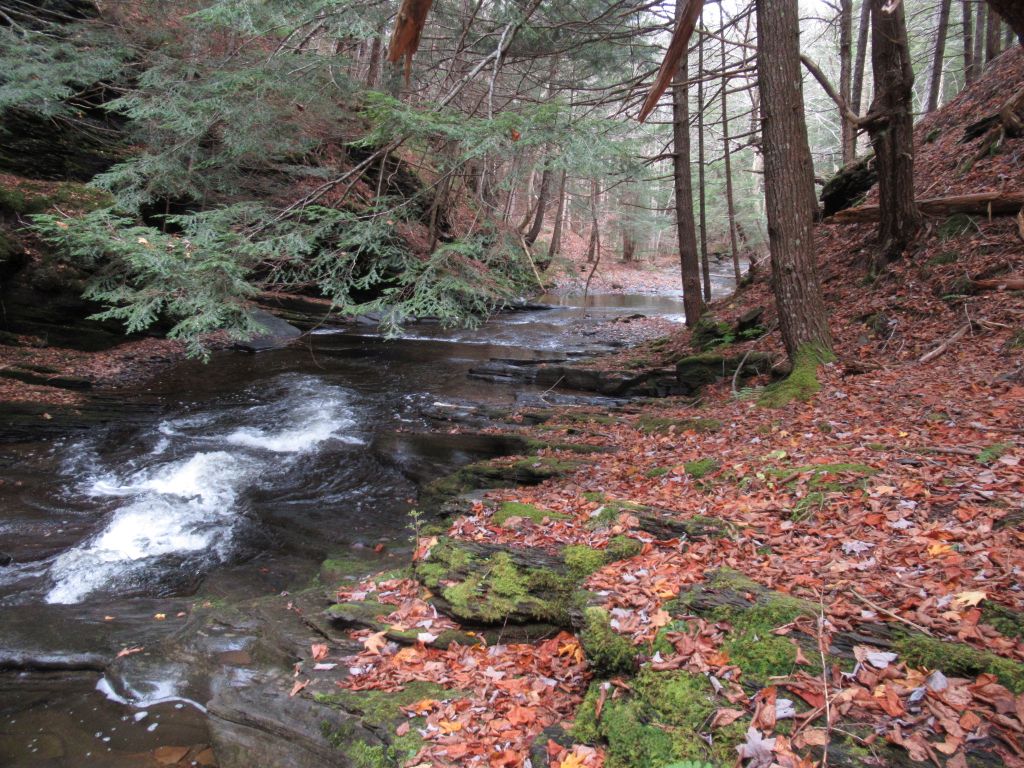
This spot was one of the most dramatic with is vertical rock wall and the stream flowing next to it. Fortunately, the opposite side of the stream did not have a steep slope and walking through was no problem. In fact on this lower hike I had no real challenge to walking up the stream. If the Curry Brook were in flood as in might be in the spring, then there would be some difficult spots. |
 |
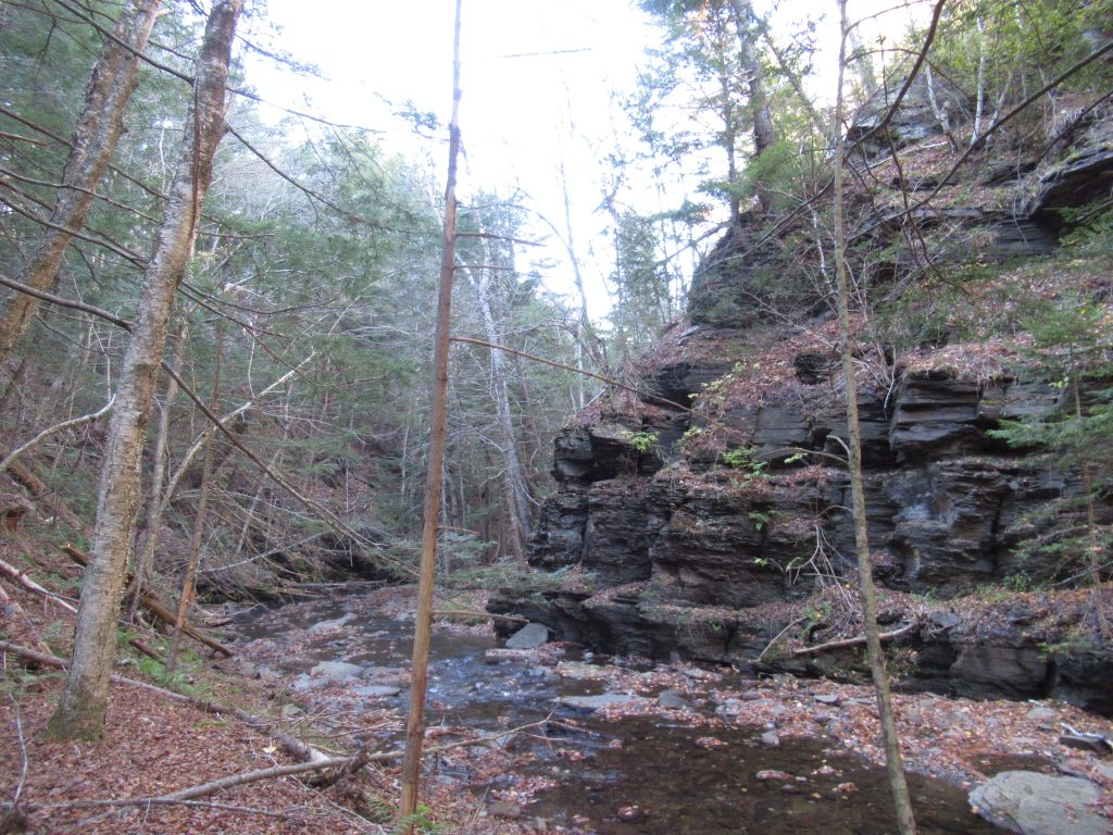
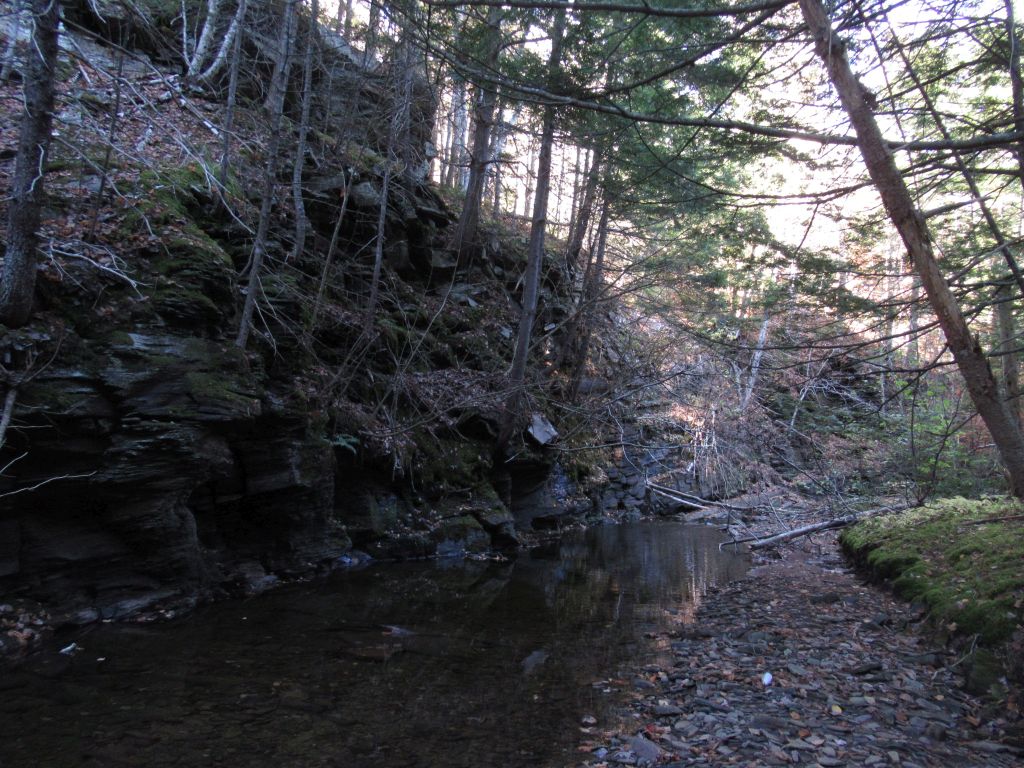
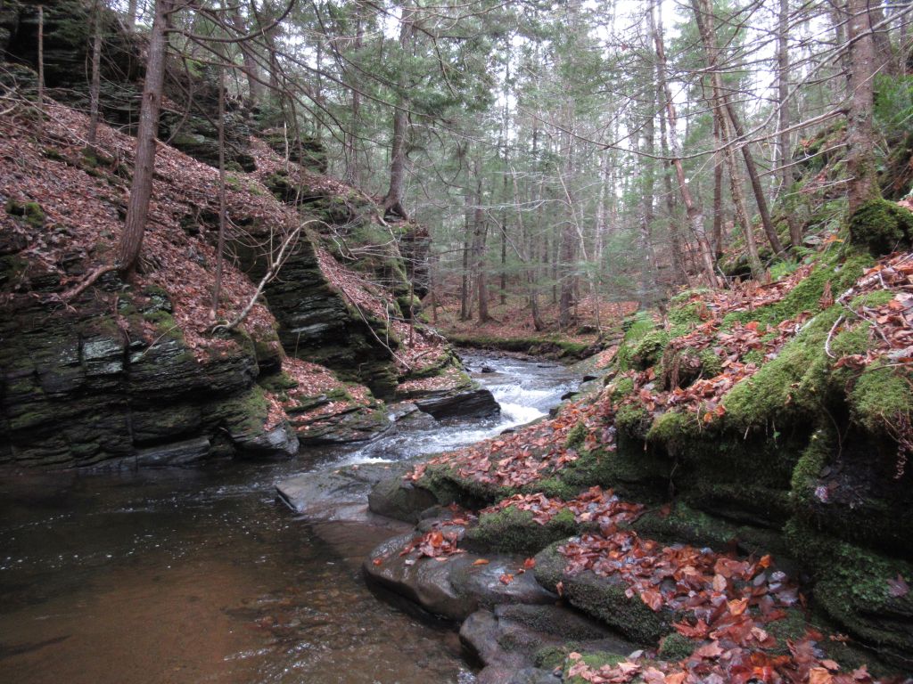
This is not the farthest up stream that I got on this day, but it was the destination for hike 2. An Earth Cache, is located here but I did not know that at the time, and it was the long rock wall and high gorge cliff that induced me to take this picture. This rock wall is similar to the previous but much higher. |
HIKE 2 (6 Nov 2020)
Access to Curry Brook for this hike was from West Brooklyn Road. There is a narrow and sometimes difficult trail from the road into the woods up then down to the edge of the gorge. At the edge the trail plummets into the gorge. There are old ropes there that are of some help to not fall. I used my staff and carefully descended not trusting ropes.
 |
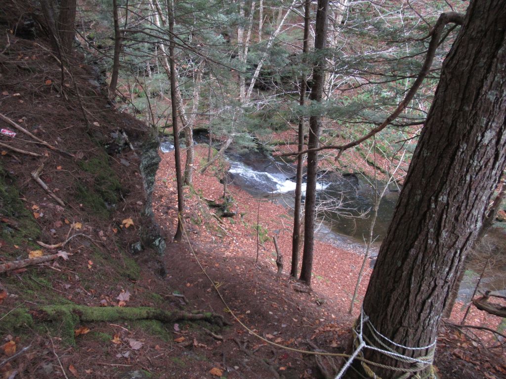
This was my view over the edge of the uplands into the gorge. Someone had created a trail from West Brooklyn Road to this spot and the way down was very steep with ropes attached to trees to make it a little safer. I believe there is a better way down just a bit north of this spot but I used what was there and made it down and up safely. |
 |
This is another view at about the same spot but half-way down the slope. You can see Curry Brook and some of the rope. When I came back from my hike, I climbed back up this way and found one of the geocaches I had missed on the way down. I also explored the side farther up stream. At this point the both sides of the gorge is steep and narrow. This allowed me to see upstream from here. A place to explore in the future. |
 |
This is a panorama of the brook from above at the entrance to the gorge on this hike. It is sort of a little hollow that has a narrow entrance and exit for the brook. The next image shows the entrance of the brook. |
 |
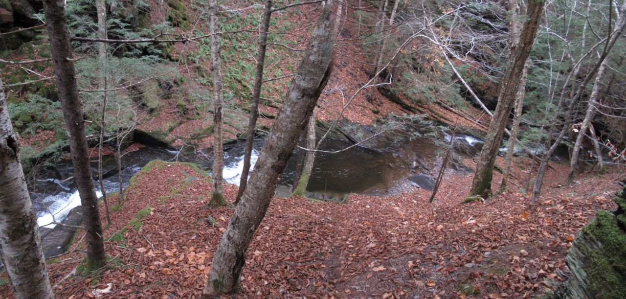
This view from the bottom of the gorge, looking at the entrance of the brook. I forms a mini-waterfall or rapids. You can see the flow was not great at the time I was there in early November. |
 |
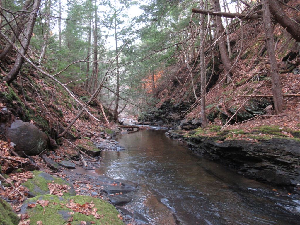
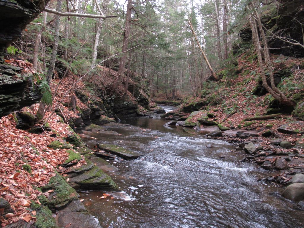
I walked downstream from the hollow toward where the 'fault' location. This view is back up stream toward the hollow and you can see the narrows. Here it is best just to walk in the stream. (if you can). There were many of these narrows just downstream of here (see next pictures.) |
 |
Narrows number two. I liked this one as there was a turn in the brook just before going through the 'slot'. |
 |
This is the third narrows and, I think, the most challenging to get through as there is a pool below the narrowest part that is too deep for my rubber boots so I had to 'siddle' along the steep sides and walk carefully. What a lot of fun! I believe the first geocache south of the hollow is downstream of here. (It would be a longer but easier walk up stream to that geocache). |
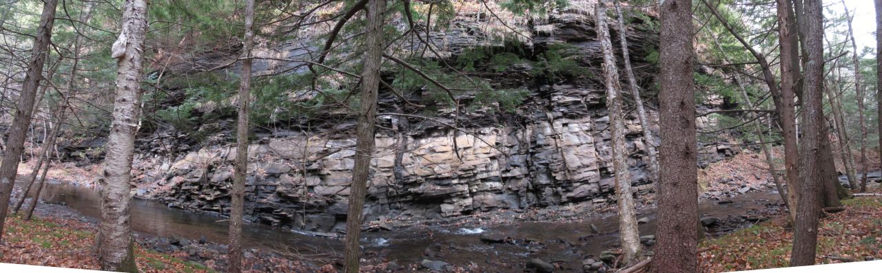 |
A panorama of the 'fault' area. [click on the image for a better view]. Down stream is to the left. There is a nice flat area opposite these cliffs and I ate my lunch there and enjoyed the view. |
 |
On my return back upstream, this is the view of the 3rd narrows from down stream. I chose the left side to 'siddle' up and had to climb carefully over the rocks and not slip. |
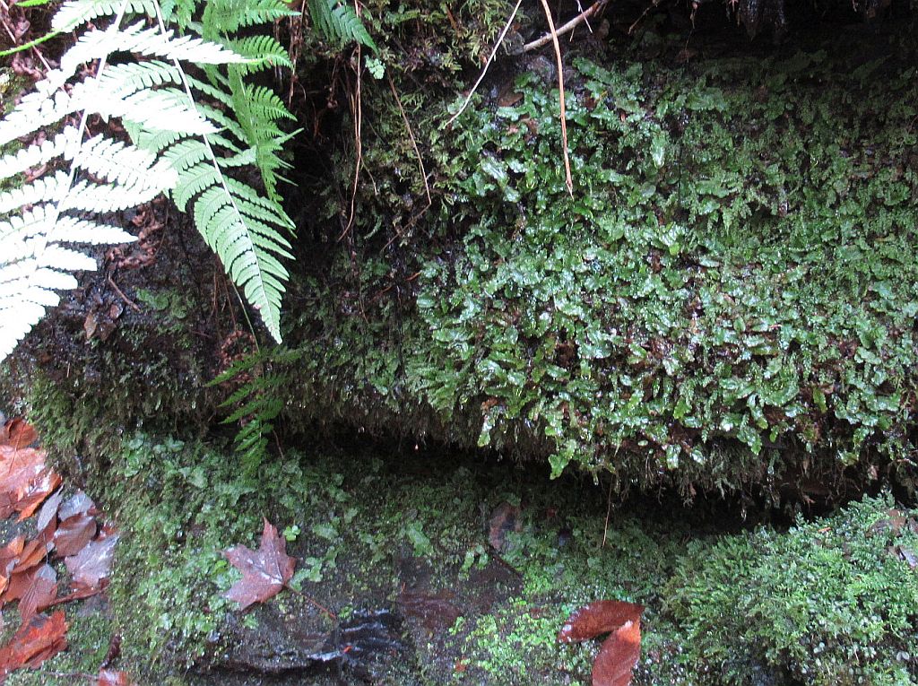 |
In November the leaves are off the trees and nothing was blooming so I only had ferns, lichen, mosses, and liverworts to look at to satisfy my natural history curiousity. This shows and interesting collectiion I found at the stream edge. Note: This time of the year was great for avoiding mosquitoes, black flies and ticks. |
The day, I hiked the Brook in November as pleasantly warm, about 16-17 C and I took my time walking from about 11 am to 2 pm. I was alone and, as always, very careful in all my movements. My practice is to have a sturdy staff to lean on while walking anywhere. It is especially helpful crossing or walking in slippery stream beds. It also stabliled me descending the steep slopes into the Curry Brook gorge.