Welcome
| Reading time: ~1 minute
Here I will report on Monarch Butterflies, Astronomical events, and ideas that I have about nature.
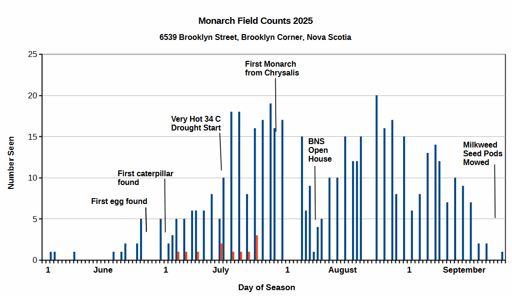
2025 Monarch Report
| Reading time: 6 minutes
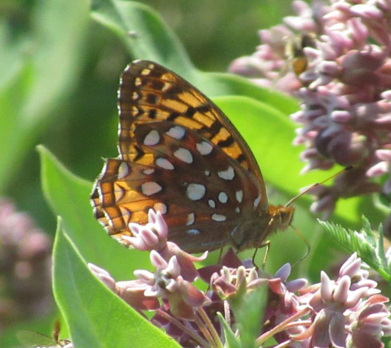
This past year the common milkweed growing in our field began sprouting in mid-May and was well up and starting to flower by the time we saw our first monarch in the field on the 2nd of June. These early arrivals were outliers of the main migration which occurred later in June.
I surveyed our field...
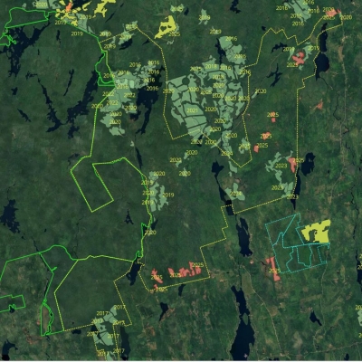
High Production Forestry Plans - Goldsmith and Chain Lakes Areas - January 2026
| Reading time: 4 minutes
Maps of High Production Forestry Plans for the Chain Lakes and Goldsmith Areas.
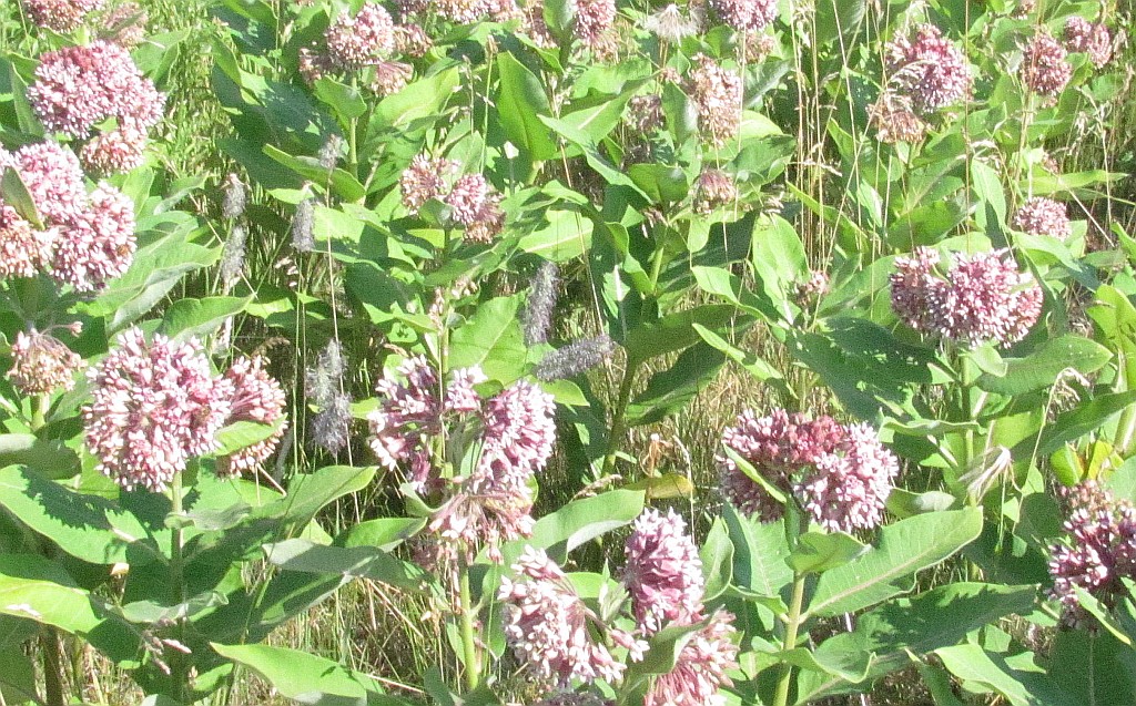
Common Milkweed in the Annapolis Valley, Nova Scotia
| Reading time: 9 minutes
Milkweed is the larval food of the Monarch butterfly which is endangered in Nova Scotia. It is of valuable to know where patches of it are located to inspect during the breeding season for larva and eggs. These early stages of the Monarch can then be protected from predators and reared to increase...
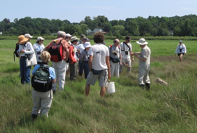
Blomidon Naturalists Society 50th Year History
| Reading time: ~1 minute
The images below are copies of the presentation describing my view of the 50 years with the Blomidon Natualists Society. This is a slide show galler. Click on the first image to start the sequence.
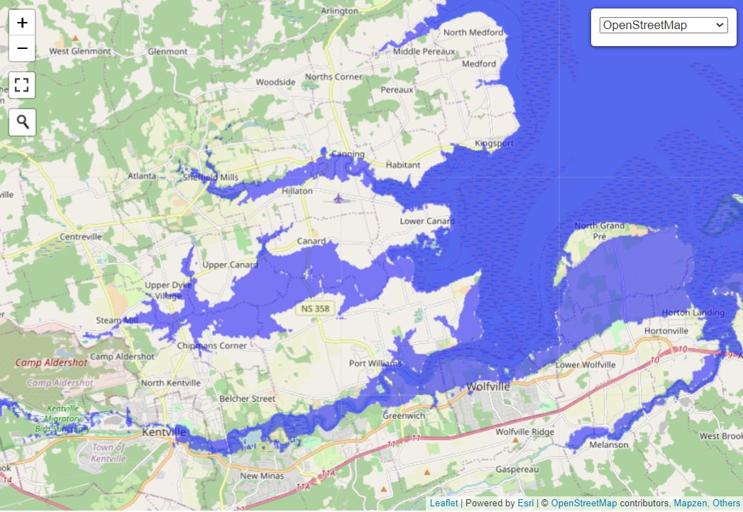
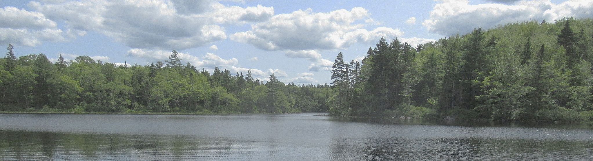
Canard River, Tidal Floods, and Acadian Dykes
| Reading time: 6 minutes
A view of the Canard River before all the dykes were built .
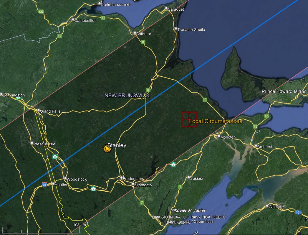
Total Solar Eclipse, 8 April 2024
| Reading time: 11 minutes
Location
The path of totality for the April 2024 Solar Eclipse crossed New Brunswick, Canada, from the St. John River Valley to the Northumberland Straits. The width of the path was 171 km. I had selected the small village of Stanley, N.B. as the sight for observing the eclipse. I set up in a nice...
Seven Falls Climb in Melvern Square
| Reading time: 11 minutes
As with my Currie Brook Adventure, I discovered this unique place when going after a geocache. This time it was only one outing and it required only one short hike. The unique quality in this site is the long continuous series of cascading water coming down from the top of the North Mountain. ...
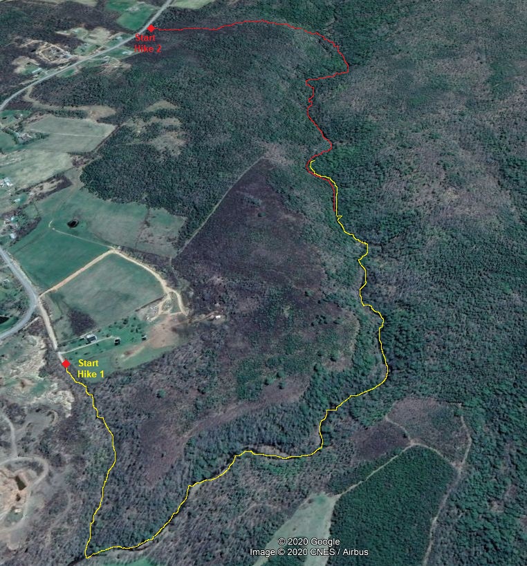
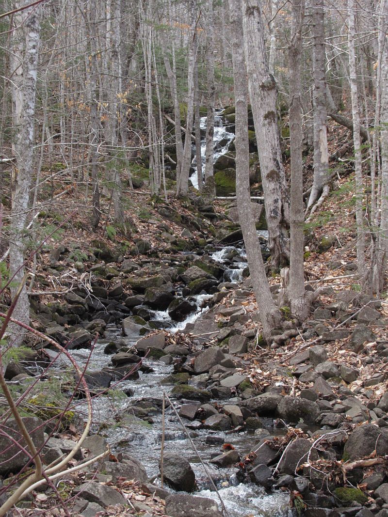
Curry Brook - Up and Down - Down and Up for Geocaches
| Reading time: 15 minutes
This is a description of my adventure in the Autumn of 2020 to explore a gorge on the north edge of the Southern Uplands of Kings County, Nova Scotia. A geocacher with the interesting moniker of Junior Woodchuck Huey, had hidden nine caches along the stream, called Curry Brook. In two separate...